
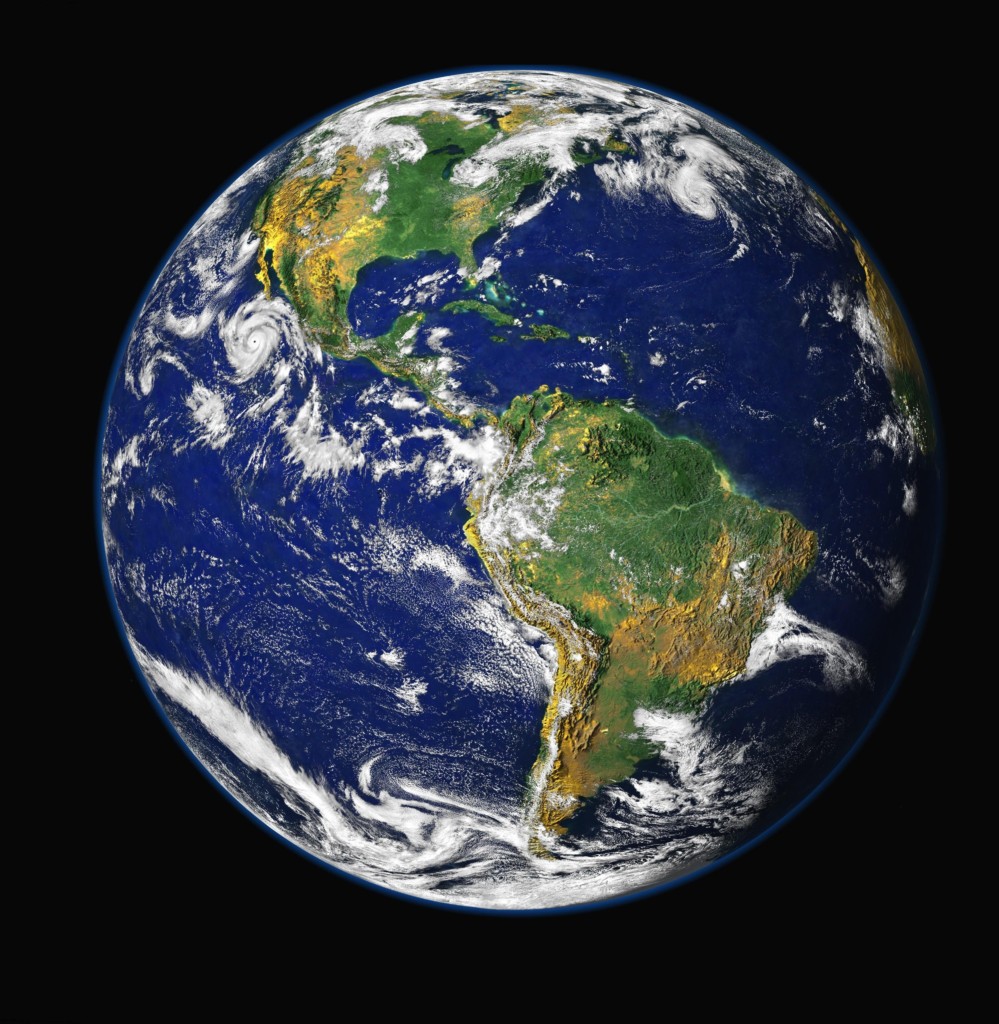
過去,地球多半被製成2D平面地圖以利觀賞,比例難免失衡,不過現在國外有個網站可以讓你輕鬆比較各大洲和各國家的實際大小,一起來看看吧!
netimpact
其實很簡單,土地離赤道越遠,在地圖上看起來就越大,而靠赤道越近就越小,所以離赤道近的國家,在地圖上看起來都會比較小。
1. 首先因為地球是圓的,所以在視覺落差上,會發現美國的領土大小會隨著你把它往北或往南移而有所改變。
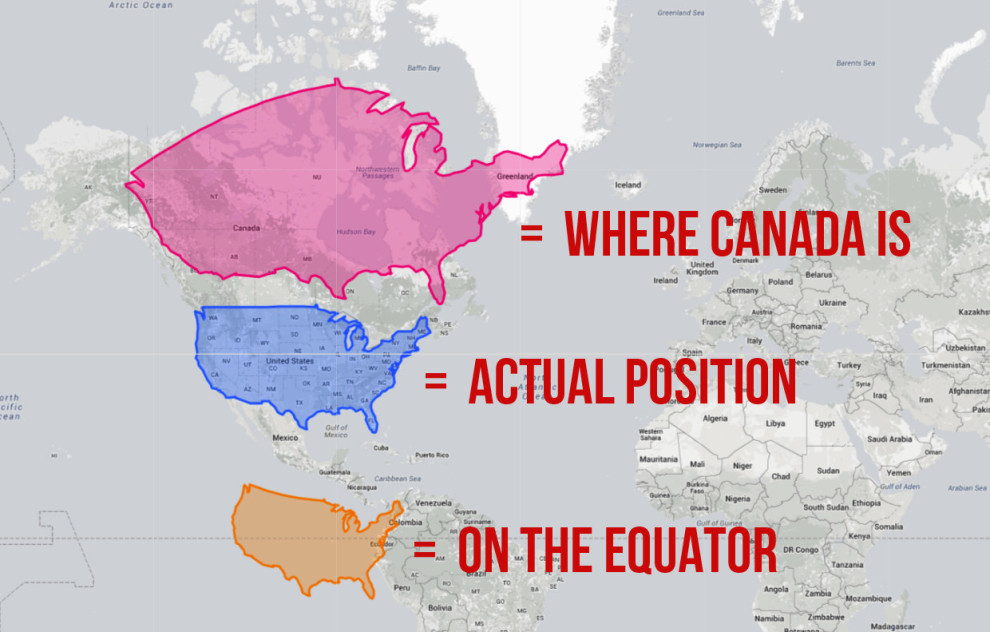
藍色是美國現在的位置,如果今天把美國移到加拿大的位置,它的土地就會變大 (粉色),如果移到赤道上的話,國土就會縮水 (橘色)。
2. 如果今天換把加拿大移到美國的位置,它的領土就會變這樣:
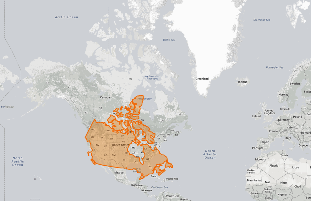
不只縮小,形狀也有些改變。
3. 如果把澳洲移到歐洲的位置,它的領土會變怎樣呢?
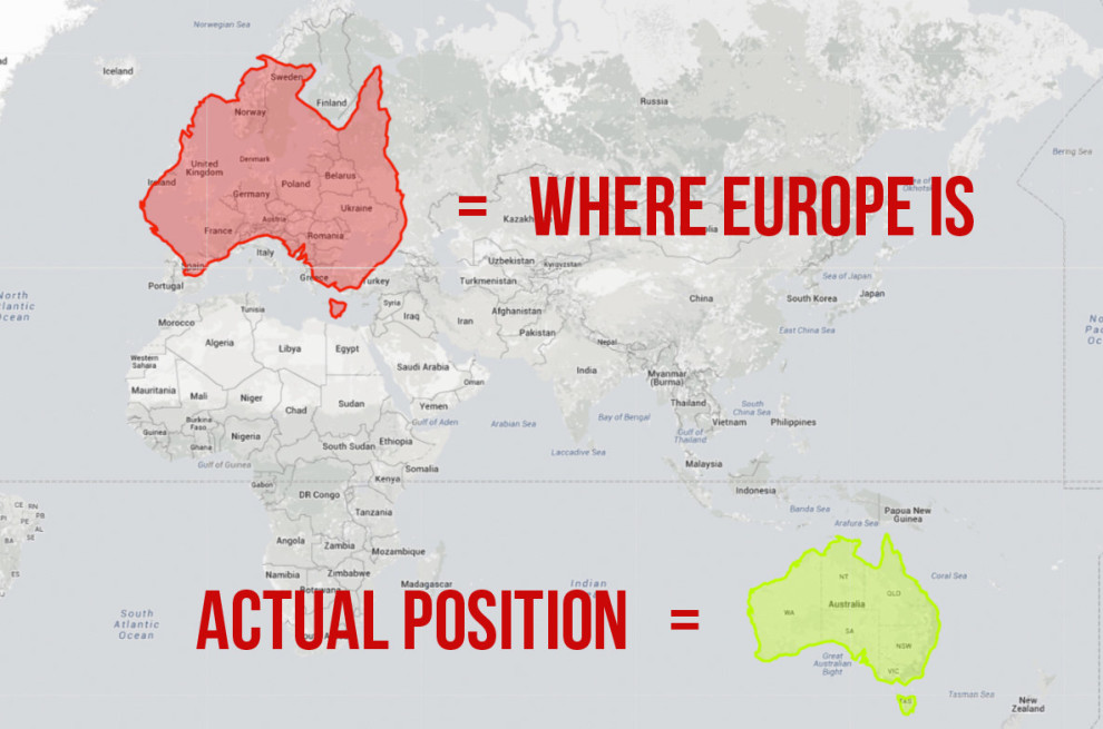
不只變大也變長了!
4. 緊鄰加拿大的阿拉斯加,如果把它往下拉的話…
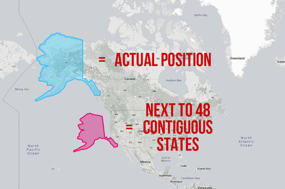
雖然土地變小了 (粉色),但還是美國面積最大的州!
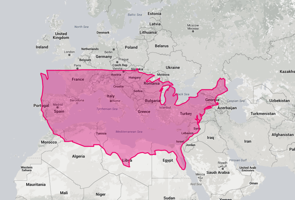
5. 如果把美國移到歐洲的話…
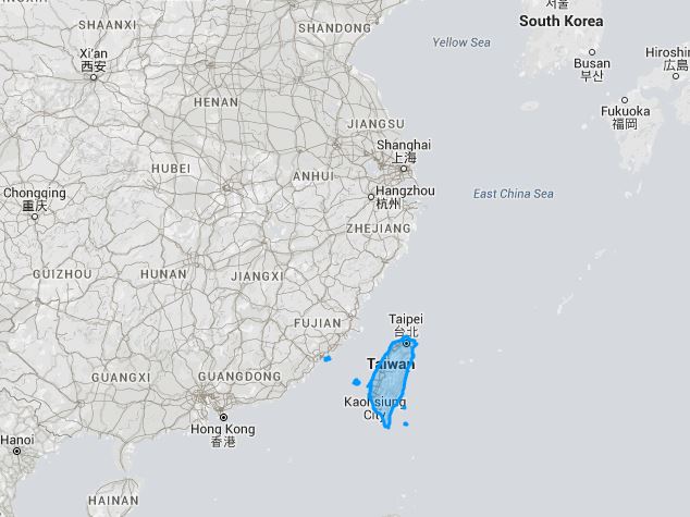
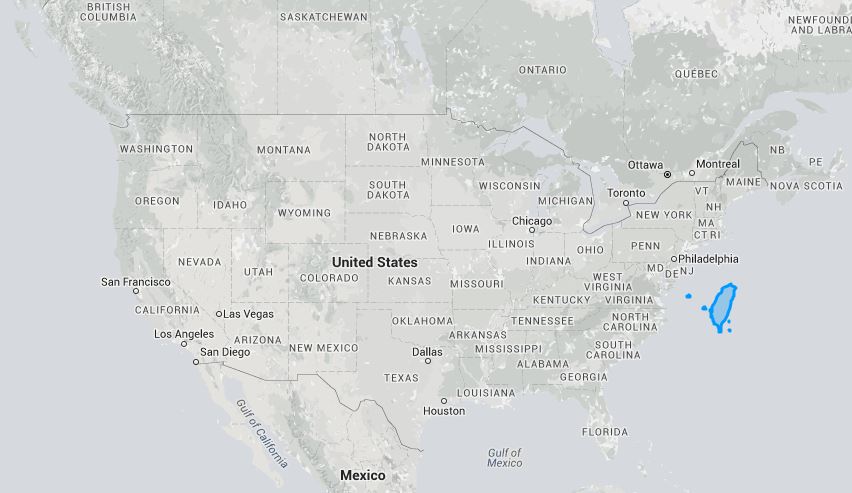
6. 現在來看看台灣!
7. 如果把台灣移到北京旁邊的話……
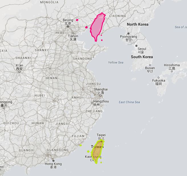
台灣和北京就快不相上下了!
8. 台灣移到美國旁邊的話:
台灣面積小所以差異不大?
9. 如果台灣移到北極海:
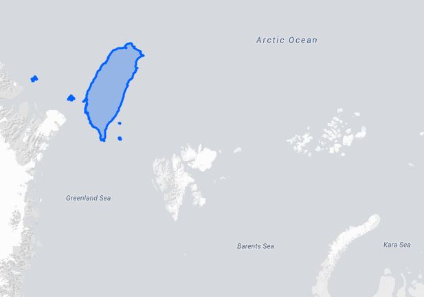
就會變成頭重腳輕的模樣!
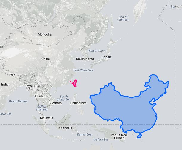
10. 那如果把中國移到赤道附近的話:
11. 如果中國灣跑去俄羅斯的位置:
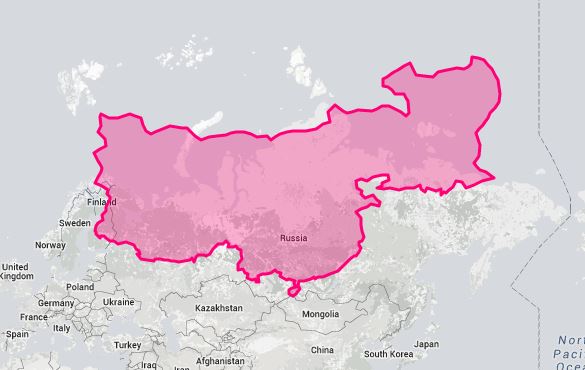
有點像一隻垂頭喪氣的公雞?
12. 如果中國跑去南極的話:
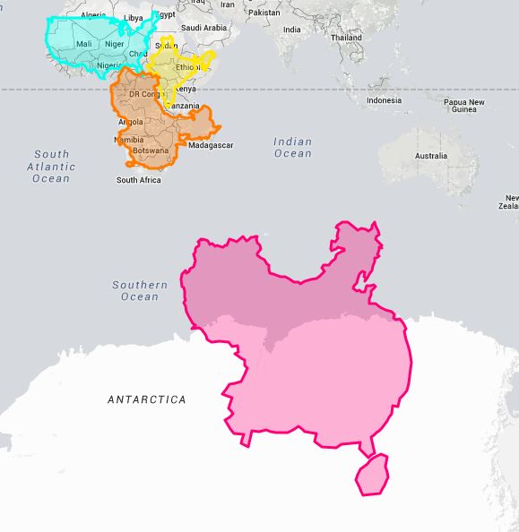
變楓葉~
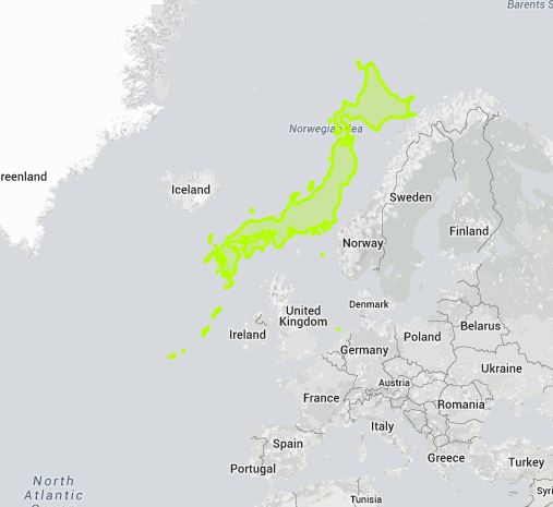
13. 把日本移到挪威旁邊的話:
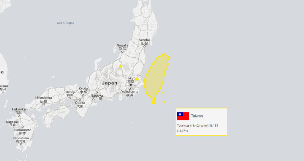
14. 又或者是把台灣移到日本旁邊…其實還不小呢!
15. 最後,把世界上國土面積前10大的國家擺在赤道上,就會是這個模樣:
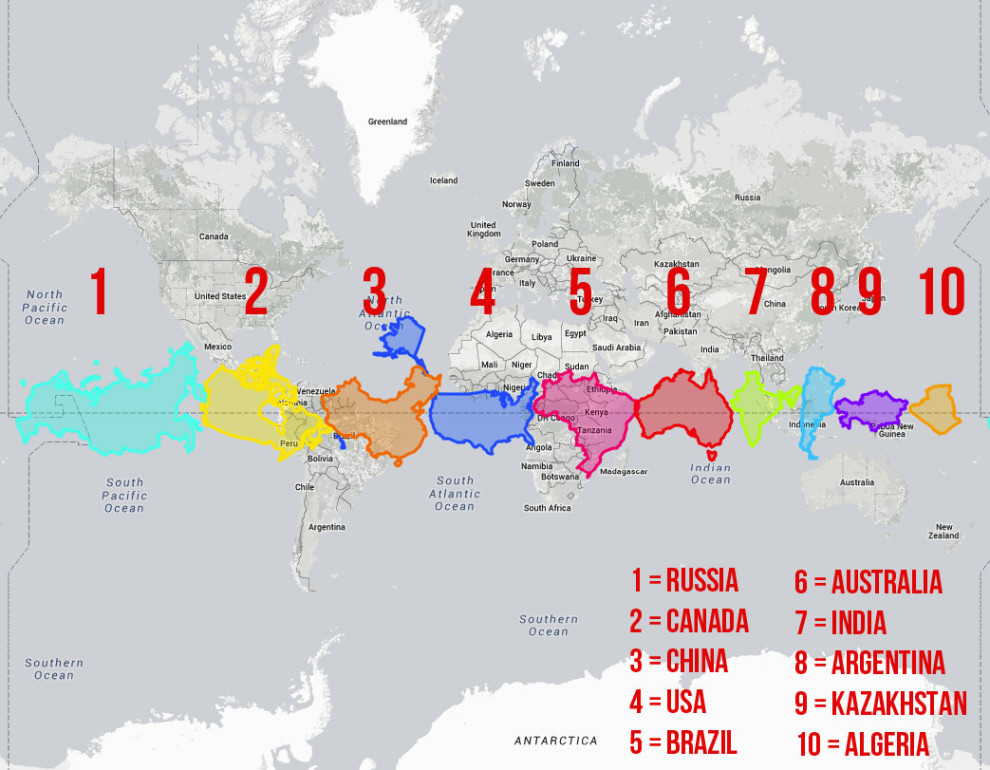
前10大的排名依序是俄羅斯、加拿大、中國、美國、巴西、澳洲、印度、阿根廷、哈薩克、阿爾及利亞。

 留言按此
留言按此
(往下還有更多精彩文章!)